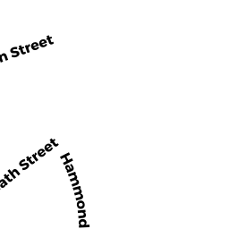
679 A HAMMOND ST
Owner Information
ROURKE JR JAMES C
679 HAMMOND ST
CHESTNUT HILL, MA 02467


Property Details
679 A HAMMOND ST is classified as a Undevelopable Residential Land.
679 A HAMMOND ST is valued at 31900. The land is valued at 31900 and the structures are valued at 0.
This property is in Zone T-6. Confirm with local Zoning Board authorities to ensure there are no overlays or other easements on this property.
The most recent deed for 679 A HAMMOND ST is recorded at the local registrar in Book 11930, Page 021. 679 A HAMMOND ST was last sold on 1997-08-04 for 115000.
Assessment data from fiscal year 2021.
Flood Data
According to the FEMA National Flood Hazard Layer, this property does not appear to be in a flood zone. It may also be in an area not yet reviewed. Nonetheless, confirm this information prior to taking any action.
To view the flood hazards around this property, create a FEMA "Firmette" Map of the area around 679 A HAMMOND ST.
Broadband Internet Providers
| Provider | Type | Bandwidth (mbps) | |
|---|---|---|---|
| HughesNet | Satellite | 25 | 3 |
| Crown Castle Fiber | Fiber | 0 | 0 |
| Viasat Inc | Satellite | 100 | 3 |
| Verizon New England Inc. | DSL | 10 | 1 |
| Comcast | Cable | 1000 | 35 |
| RCN | Cable | 500 | 20 |
| RCN | Cable | 1000 | 20 |
| GCI Communication Corp. | Satellite | 0 | 0 |
| VSAT Systems, LLC. | Satellite | 2 | 1 |
Broadband service provider data from December 2020.
Adjacent Properties
- 584 HEATH ST
Church, Mosque, Synagogue, Temple, etc... owned by ROMAN CATHOLIC ARCHBISHOP - 687 HAMMOND ST
Two-Family Residential owned by LEUNG ET AL RICHARD C - 681 683 HAMMOND ST 683B
Residential Condominium owned by WHITMORE ERIKA L - 681 683 HAMMOND ST 681A
Residential Condominium owned by BENSON CANDYCE - 681 683 HAMMOND ST 681B
Residential Condominium owned by NURME R DAVID & LISA B - 681 683 HAMMOND ST 683A
Residential Condominium owned by GATES TRS PETER R & DEBORAH M - 679 HAMMOND ST
Single Family Residential owned by ROURKE JR JAMES C